Category Archives: Places we Visit-Year 1

(locations align with the map showing our route)

Fort Bragg, CA

Yesterday we drove up Hiway 1 along the coast from Larkspur to Fort Bragg.  Beautiful coastline – steep and sometimes sheer cliffs, rocks in the surf, forests and meadows.  It took a lot longer than we expected as the going was slow in a lot of areas and we went through several very small towns of 200-400 people where the speed limit slows to 25mph.

But, we got here and got set up at our new site, at Dolphin Isle.  Our trailer is against a riverbank that is forest on the other bank and there’s a marmarina on the other side of the RV park.

A full-time resident here at the RV park makes his living carving deer antlers and pieces of wood into walking sticks and decorative pieces, sometimes adding gems or interesting stones to them.  He was very taken with Laddy and gave him a small piece of antler to chew on.  Laddy carried it all the way back home in his mouth and has been gnawing on it all evening.

Fisherman’s Wharf and a WWII submarine tour

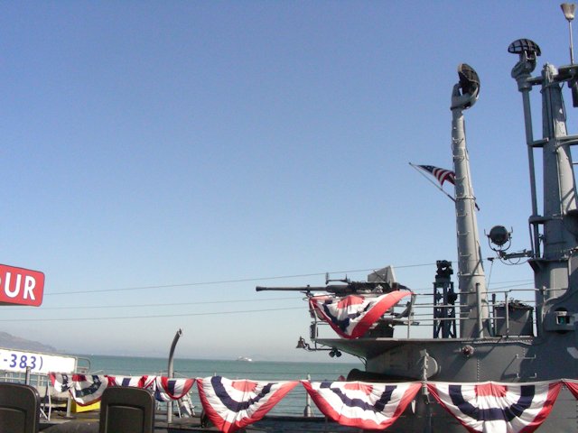
We walked through Fisherman’s Wharf and had some GREAT food – I had a crab sandwich on a real sourdough roll (YUM!) and Jeff had fish and chips.  At the pier where the marine historical society is at there was a WWII submarine open for tours so we went inside and was able to walk through it.  Boy, talk about cramped spaces!  Getting through the hatches was more difficult than I thought it would it – in movies you see the guys grabbing the top and swinging through it but as I’m not a very fit 20 year old I had to sort of crawl through.  Jeff too as he’s much taller than any real submariner would be!  Here are a few pictures we took:


San Francisco pictures

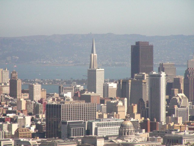
Here are some misc. pictures we took while touring San Francisco:

One block of Lombard Street in the city is so steep that instead of just making it a steep street (many we saw are about 15% grade (note that you’ll see many warning signs and truck brake inspection places etc. when you get about an 8% grade) they had to put in switchbacks.  People actually live on that block and have little parking spots right along the switchbacks.  We saw pedestrians walking down the hill and they had to hang on it was so steep!  Notice in the pictures looking down there were hoards of tourists at the bottom taking pictures!

Also included in this photo gallery are pictures of the city from the highest point called “Twin Peaks” (910 ft!)


Golden Gate Bridge

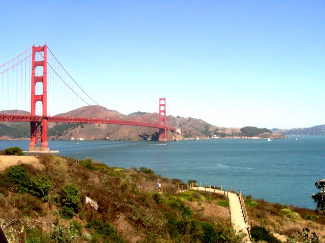
We’ve been across the Golden Gate Bridge twice, once in our truck and once in a bus.  Plus, there are views of the bridge from many parts of the city.  During our walking tour of Fishermans Wharf we noticed a heavy fog coming in – a couple of the pictures below show just a little bit of the bridge through a heavy fog!

Marin County, just across the Golden Gate Bridge from San Francisco

We’re now in an RV park in Marin County, CA – just north of the Golden Gate bridge and San Francisco.  We’ve gone into the city twice, once in our truck to drive around, get our bearings and see parts of the city we can’t walk to, and then once by bus so we could walk around in Chinatown, Fisherman’s Wharf etc.

Our RV park, Marin RV Park, is just west across a small bay area from San Quentin.  When we walk Laddy along the estuary behind the park we are looking at the prison.  A little spooky!

See other posts from this area for pictures of the bridge and city!

Monterey Aquarium – fabulous!

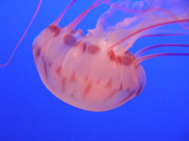
Morgan Hill isn’t too far from Monterey Bay and the city of Monterey, and we spent a day at the Monterey Aquarium.  It’s a great place!  Here are a few pictures that Jeff took while there:


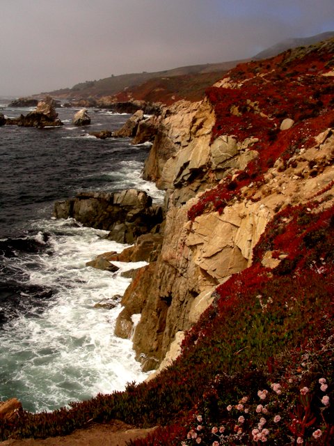
Big Sur – rocky cliffs along the ocean – it was a FABULOUS drive!

We took a day trip and drove down to the Big Sur region of the coast.  While it was quite foggy all morning, it did clear up around lunchtime enough so we could see the coastline and get some great pictures.  One place in particular was fascinating – at the Jula Pfieffer State Park there was a waterfall right on the beach!  No beach access but there was a trail along the cliffs with a great view of the waterfall for pictures.  Several of the pictures in the slide show below are of that waterfall, the rest are of various places where the cliffs along the beach were really breathtaking!

We took Laddy down to the beach in one area that he was allowed (no dogs allowed on State Park trails, but dogs ARE allowed on the trails in national park/forest areas) and we walked along the shore for a while with him.  One wave came in quite high and got about ankle deep for Laddy and for me – COLD water!!  After that he stayed away from the water, LOL

Enjoy the photos we took:


From Three Rivers to Morgan Hill

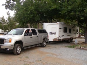
Today was a travel day, so right after breakfast we started the process of stowing and readying our trailer for travel.  It was actually sprinkling as we were hooking up the trailer.  But, after several weeks of 90+ temperatures in Julian without A/C, and 100+ temperaturs in Three Rivers (at least we had A/C!) it was a very nice feeling to get a little wet and be cool!


Heading Out

So, off we go today from Three Rivers to Morgan Hill, which is south of San Jose/about 30 minutes from the Monterey Bay.  Here in Morgan Hill it’s about 73 degrees and our site is in full shade.  We’ll have to get our sweaters out LOL!

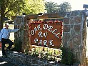
Here’s our new RV Park, Oak Dell RV Park.  Very pretty, quiet, shady, a lot of the people here appear to be “long time” residents in trailers and RVs.  Many of them have flowerpots, enclosed decks etc.  We’re just here for a week though.

Oak Dell RV Park

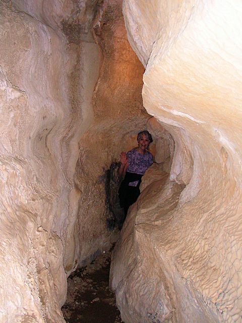
Exploring a cavern in Kings Canyon (a guided tour, we’re not that brave) :-}

Back in 1906 a logger named Boyden was exploring the area around Kings Canyon and chanced upon a cavern.  He explored it a bit and then went back to where he worked (several miles away) and filed a miners claim to the area around and including the cavern.  It was the only way to protect the cavern back in 1906.

He owned the claim for more than 10 years and in that time he took hardy tourists and cave explorers through the cavern for a quarter each.  At this time (1906-1916) there were no roads so it was a hike through steep hills and rocky terrain to even get to the cavern!  He lived in the cavern during the winters and in a small cabin nearby during the summers.

Once he was exploring the cavern on his own in the early spring, a time when water rushed through the cavern about shin-high, and he lost his balance in the rocky streambed and broke his lantern and got all his matches wet.  Alone in the pitch black, he survived by crawling along the streambed for over 3 hours knowing it would lead him to the cavern entrance.  When he died many years later he had no family to inherit the claim so it passed to the state and became part of Kings Canyon when the national park was formed.

We took a one-hour guided tour through the cavern.  Very interesting, in a few places we had to duck under stalactites and squeeze through narrow areas.  Well lighted except when the tour guide turned out the lights to show us what Boyden endured at least once.

Enjoy the pictures Jeff took:

Latest Location: Sequoia National Park

We drove from Julian to Three Rivers, Ca just outside the entrance to the Sequioa National Park on Friday August 17th.  Long drive but an uneventful one which is good.

It’s even hotter here than it was in Julian, they’d been having highs of 104-106 and Friday it was a bit cooler (ha!) at 98.  So we were really glad our A/C is again working.

On Saturday we went into the Sequioa National Park.  I drove to give Jeff a break as he’s done all the driving so far.  Very windy road and you start at about 1,000ft and end up over 5,000ft!

There was constructions going on and a couple of miles of that narrow, very windy road was down to one lane and delays of about 20 minutes while folks going the other direction made their way through the construction area, then we went.  Luckily the place where we had to stop and wait had a fabulous view of Morro Rock. A different Morro Rock than the one in the beach near Morro Bay of course, but just as magnificent!

We went into the “Giant Forest” and as far as the General Sherman Tree area.  The parking area to go see the General Sherman tree is about .5 miles away from the tree itself, so there’s a hike to see it, but downhill all the way.  The tree itself, and many others in that area, is truly magnificently huge!  Jeff exclaimed several times that he’d seen pictures and knew they would be big, but until you actually stand under them and see how large around and how tall they really are you can’t imagine what it’s really like.  The park service made the trail very nice because in addition to a choice to hike back UPhill .5 miles to reach your car there’s a very slight downhill trail to some accessible parking and a shuttle will take you back to your vehicle.  That’s what I wanted…no uphill strenuous hike for me!

The temperature change from the lower area where it was mid-90s to the Giant Forest where it was sprinkling and about the mid-60s was interesting.  We hadn’t expected that much of a change, but it felt REALLY nice to have a cool breeze and some rain and it made the forest smell really good.  It was fortunate as well for Laddy – we took him on the drive with us and he was very comfortable staying in the car while we hiked down to see the General Sherman tree…dogs not allowed on the trails!

We took lots of pictures and they are in some separate posts.